卞山半岛海岸公路
卞山半岛海岸公路从穿越新万金防潮堤后,在全北扶安郡卞山面大港里与国道30号线海岸公路相接开始。该路线沿曲折的海岸线延伸,途经采石岗、格浦港和熊沼港,全长35.4公里,是一条理想的驾车路线。这里不仅有宽广蔚蓝的海洋,还有宁静的海岸村庄、经数万年波浪侵蚀形成的独特海岸悬崖、丰富的潮间带生态,以及神秘的卞山半岛国家公园外卞山主要景点和大小海滩。
这个地方怎么样?
这条路线是 2 天行程示例。你可以直接保存,或扩展为 AI 行程。

第1天
Gosapo Beach 〉


Gosapo Beach is located in Unsan-ri, Byeonsan-myeon, Buan-gun, featuring a white sandy beach about 2 km long and a wide, long pine forest about 300 m planted for wind protection, creating a magnificent view. It boasts the largest scale among the area's beaches. The water is clearer and cleaner than other beaches on the West Sea, and the sand is known to be fine and soft. The water temperature is moderate, making it a popular spot for family tourists who enjoy sea bathing in summer. The pine forest is suitable for resting in the shade or camping after enjoying the sea. It is also famous for its beautiful sunset, typical of West Sea beaches. Around the 15th day or the end of each lunar month, a sea path about 2 km long, called the modern-day miracle of Moses, opens from the beach to here. At this time, visitors can walk to the island and enjoy catching clams, octopus, sea cucumbers, and more. In front of the beach, there is a small island called Haseom, named for its resemblance to a shrimp. It is owned by the Wonbulgyo Foundation, and the general public must obtain prior permission to enter the island, but mudflat experiences to the island are allowed when the sea path opens.
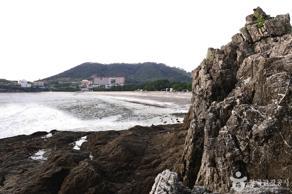
Chaeseokgang 〉


This sedimentary rock, formed about 70 million years ago from the Cretaceous period of the Mesozoic era under marine erosion, consists of the Gyeokpori Formation including conglomerate over conglomerate, alternating layers of conglomerate and sandstone, sandstone and mudstone, shale, and volcanic ash. This sedimentary environment suggests this area was once a deep lake where volcanic ejecta settled on the lakebed. Faults, folds, intrusion structures, and wave-cut platforms are also easily observed in these cliffs, making it excellent for studying topography and geology. Wave erosion has created sea cliffs, flat wave-cut platforms, and sea caves. The bottom of Chaeseokgang features potholes formed through crust and wave action, along with tidal pools formed by seawater trapped during high tide. ◎ Travel info to experience the charm of cold currents - The drama begins where Ban Ji-eum, carrying memories of a past life like waves, slowly walks at the towering cliffs and sea caves. The sedimentary rock formed since about 70 million years ago during the Cretaceous period seems to reflect the long years she has endured.
第2天
Sangnok Beach 〉


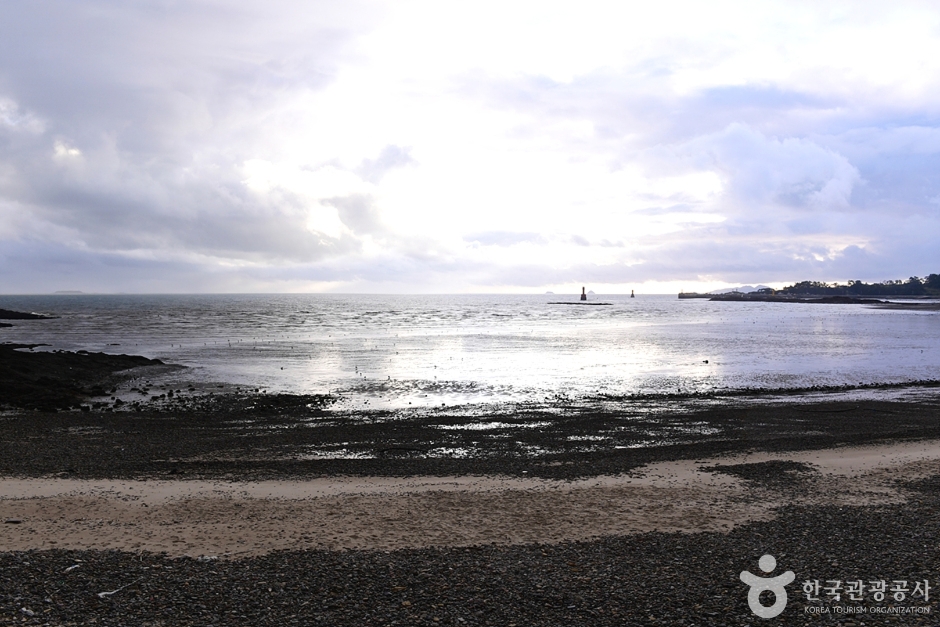
Sangnok Beach is located in Unpo Village, Docheong-ri, Byeonsan-myeon, Buan-gun. Since its opening in 1988, it was initially only available to public officials and their families but is now open to the general public. Behind the sandy beach is a windbreak forest made of pine trees and scattered strange rock formations. The water is shallow, and the sand is clean. In a 1999 water quality test, it received first-grade status. Around the beach, there are well-equipped convenience facilities such as restaurants, a swimming pool, volleyball court, shower room, cooking area, and camping site. Additionally, a natural camping site in the pleasant pine forest operates for a fee. It is located in section 4 of the West Sea Trail 46 course and Buan Byeonsan Masil Trail Coastal 8 course, covering 'Gyeokpo Port~Gung Port~Sol Island.' Starting from Gyeokpo Port, passing the Jeolla Left Naval Command set, Gung Port, and reaching Nonghyup Byeonsan Training Center, Sangnok Beach is visible. The beach is about the midpoint of the approximately 5 km Masil Trail, making it an ideal spot for round-trip trekking toward Gyeokpo Port or Sol Island.
Gomso Port 〉


Gomso Port is located around Jinseo-ri, Jinseo-myeon, Buan-gun. It is the second largest port after Gunsan Port. When Julpo Port was closed due to sedimentation, in 1938, a seawall was built linking Gom Island in front of Jinseo-ri with Beom Island and Yeondong to the east, and Ggachi Island and Jakdo-ri to the west, creating this harbor. It is a forward base for West Sea fisheries. The name Gomso comes from two islands shaped like bears and the deep pools in front of these islands, with a proverb saying "Gomso is deep like a bear's pond." Ferries operate to Wido. Gomso Port is active, with about 130 fishing vessels entering daily. Surrounding Gomso Port are large-scale salt fields, the largest salted seafood market in Korea called Gomso Jeotgal Market, a seafood market, and a dried seafood market, attracting many tourists. Salt fields literally mean 'fields where salt is made.' Salt is made by drying seawater with wind and sunlight in salt fields, called natural solar salt, distinct from factory-made chemical salt. Salt production involves reservoirs, evaporation ponds, and crystallization ponds. Seawater is stored in reservoirs during high tide, then sent to evaporation ponds through long channels, containing 5% salinity. After 7–8 days of evaporation there, water moves to crystallization ponds (salt fields with jar-piece tiles). Mixing about 30kg of existing salt with evaporated water creates foam; bubbles attach to evaporated alkali and sink. This brine has about 25% salinity. After 2–3 days drying by wind and sun in crystallization ponds, salt forms, which is raked and stored. The natural solar salt made here creates the famous Gomso salted seafood, widely acclaimed nationwide with many visitors eager to purchase it.
这条路线更适合在这里住一晚
精选了路线周边移动方便、满意度高的住宿


该城市的其他推荐行程
旅行评价
分享你的旅行小贴士,也让更多人看到你的社交账号。
注册成为会员,让更多人认识你的频道。
(成为会员后,在“我的页面”中设置 Instagram、YouTube、博客链接,我们会在你发表的每条评论旁一起展示。)
- ✔ 你发布的每一条评论旁都会显示你的社交账号链接。
- ✔ 如果你的评论被选为「最佳评论」,我们还会在首页顶部突出展示你的留言和社交账号。
““住在弘大附近,晚上去了一圈咖啡馆,城市夜景和氛围都太完美了。””
以访客身份发表的评论,不会显示任何社交账号链接或个人资料卡片
写下一条旅行短评
分享一条关于这个地点的小贴士吧。
或者以访客身份快速留下一个评论。
拖拽或点击添加图片(最多6张)
还没有任何评论,快来写下你的第一条感受吧!